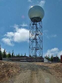
A proposed new Doppler weather radar in southeastern Missouri could provide earlier and more accurate severe weather information for communities across Southern Illinois, including Wayne County and surrounding areas.
The radar, planned for a location near Van Buren, Missouri, would help fill a significant gap in weather radar coverage by allowing meteorologists to better observe the lower portions of developing thunderstorms.
Officials with the National Weather Service in Paducah, Kentucky, say the additional coverage could help forecasters identify dangerous storm developments before those storms cross the Mississippi River into Illinois.
Christine Wielgos, warning coordination meteorologist with the Paducah National Weather Service office, says the radar would provide a much clearer picture of thunderstorms, heavy rainfall and winter weather.
Currently, existing radar systems have difficulty detecting storm features closer to the ground in portions of southeastern Missouri because radar beams travel higher above the Earth’s surface as the distance increases.
Wielgos says the lowest radar beam over portions of Carter and Ripley counties in Missouri is approximately 12,000 to 13,000 feet above the ground. That makes it difficult to identify smaller storm features, including developing rotation.
A new radar closer to those communities would allow meteorologists to monitor changes in storms more effectively, potentially improving advance warnings for areas farther east.
For residents of Southern Illinois, including Wayne, Edwards, White, Hamilton, Jefferson and surrounding counties, improved observations could give forecasters additional information as severe weather systems move eastward.
The project has secured approximately $2.4 million in funding, including $2 million from the State of Missouri and an additional $396,000 from the Delta Regional Authority.
The proposed location is near Eastwood in Carter County, outside Van Buren. Local officials plan to purchase the property and hope to begin accepting proposals from radar manufacturers before the end of the year.
The radar manufacturer and model have not yet been selected, meaning its exact coverage area and capabilities remain undetermined.
Officials hope to have the radar operational by spring, although no firm completion date has been announced.
Wielgos estimates that site preparation and installation could take approximately four to five months once the project moves forward.
National Weather Service officials say the additional radar coverage could become an important tool in tracking dangerous storms and improving warning decisions for communities throughout the region.