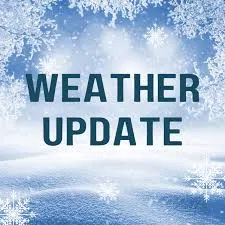
Southern Illinois is still facing facing hazardous winter weather conditions around the area. The National Weather Service in Paducah says persistent light snow showers and refreezing of melted snow and ice has led to spotty areas of black ice developing across the region. Drivers should use extra caution, especially if traveling on untreated secondary roads and bridges. Sidewalks and parking lots may become slippery as well. Sub freezing temperatures along with forecasted wind chills ranging from around zero in the north to around 10 degrees in the south again for late tonight. Highways in the area are clear with secondary roads along with country roads remaining very slick and hazardous. The chance for accumulating snowfall Friday is heightening, including the risk for elevated impacts. Schools across the area remain closed today and there are numerous closing and cancellations and you can check those out under the Closing & Delays link on our website, wfiwradio.com.
The Illinois Department of Transportation (IDOT) and Illinois State Police remind motorists to slow down, increasing braking distances, and maintaining safe distances between vehicles.
For ongoing updates, individuals can check road conditions at GettingAroundIllinois.com and follow IDOT on social media platforms like Facebook and X.