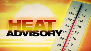
The National Weather Service in Paducah, Kentucky, has issued a Heat Advisory for the southern Illinois region, beginning at noon today and running through 7 p.m. Tuesday. Forecasters say high temperatures are expected to reach the upper 90s Monday and Tuesday, with heat index values up to 105 each afternoon before a slight cooldown by midweek. Only small chances of rain are in the forecast Sunday and Wednesday.
As far as area rivers this morning, the Little Wabash River east of Fairfield is at 10.76 feet, below the 17-foot flood stage. At Clay City the stage is 5.84 feet. Flood stage is 18 feet. At Carmi the river is at 6.33 feet. Flood stage is 27 feet. The Skillet Fork at Wayne City reads 5.11 feet. Flood stage is 15 feet. The Wabash River at Mt. Carmel is at 4.96 feet. Flood stage is 19 feet. Bonpas Creek at Browns is at 1.27 feet.
With the dry conditions recently, some Abnormally Dry conditions have crept back into far southwestern Illinois, according to the latest U.S. Drought Monitor Map. Moderate drought conditions are noted in east-central and northeastern Illinois.
The extended forecasts call for near normal temperatures and below normal precipitation in the six to ten day outlook, and above normal temperatures and normal precipitation in the 8 to 14 day outlook, which runs through August 29th.