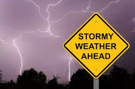

The National Weather Service reports that warm temperatures will settle into the region today (Wednesday), with highs climbing into the upper 60s and low 70s. However, residents are urged to prepare for a dramatic weather shift starting tomorrow (Thursday), as a significant pattern change brings the risk of severe storms.
Forecasters warn that damaging winds, tornadoes, and even hail are possible Thursday afternoon and evening. This severe weather event is being fueled by an influx of warm, moist air combined with strong wind shear.
Following the passage of a cold front, temperatures are set to tumble heading into the weekend. Highs on Friday will only reach the low 50s. By Saturday, light rain is expected, which could mix with or transition to light wet snow by evening. While significant snow accumulation is unlikely, the chance of wintry precipitation marks a sharp change from the week’s earlier warmth.
The cold snap will continue into Sunday and Monday, with highs struggling to reach the upper 30s to lower 40s—well below normal for this time of year. The National Weather Service encourages residents to stay weather-aware and be prepared for rapidly changing conditions.